|
|
|
 |
|
"ARISE, WALK THROUGH THE LENGTH AND THE BREADTH
OF THE LAND FOR I WILL GIVE IT TO YOU”
GENESIS 13:17
|
|
|
 |
|
|
|
 |
| |
Edward
Robinson, born in Southington, Connecticut, realized
a childhood dream when he came to the Holy Land in
1838 to research biblical geography. After
publishing Biblical Researches in Palestine,
Mount Sinai and Arabia in 1841, Robinson was
recognized as the foremost biblical scholar of his
day. He succeeded in identifying nearly 200
sites mentioned in the Bible, which were previously
unknown. With the passing of time, Robinson’s
reputation has only been enhanced. To this day, he
is considered the “Father of Biblical Geography.”
As a Connecticut Yankee, Robinson had the knowledge
to seriously tackle biblical geography. From
the days of the Pilgrims, when they stepped onto
Plymouth Rock holding the King James Authorized
Version of the Bible in hand, the Good Book was a
vital component of New England education, worship
and daily life. This may explain why the first
printing of Robinson’s book -- in 5,000 copies --
was quickly sold out.
|
“Indeed in no country in the world, perhaps, is such
feeling more widely diffused than in New England, in
no country are the scriptures better known, or more
highly prized. From his earliest years the
child there is accustomed not only to read the Bible
for himself, but he reads or listens to it in the
morning or evening devotions of the family and in
the daily village school, in the Sunday school and
Bible class….”
(From Robinson’s Biblical Researches in
Palestine, Mount Sinai and Arabia, published
in Boston, 1841)
|
Fluent in Hebrew, Greek, Latin, German, the Old and
New Testaments, and the works of first century AD
historian Josephus Flavius, Robinson wisely chose as
his traveling companion, Pastor Eli Smith (also born
in Connecticut!) who had served as a missionary in
Beirut. Smith was fluent in Arabic and
familiar and comfortable with the customs of the
Middle East. Robinson prepared himself for
this pilgrimage by diligently going through all the
accessible literature on Palestine, collating every
bit of information on file cards.
|
Robinson brought with him two pocket compasses, a
thermometer, telescope and measuring tape. He
brought the Bible not only in English, but also in
Hebrew. Robinson, Smith and a cook rode on horses
while 3 mules carried their tent, sleeping bags and
food. Their daily expenses came to under $5
per day. The "firman," (a permit from
the Turkish sultan) which gave them the right to
travel freely around the country, was their most
important possession.
Robinson and Smith each kept their own diary and only
later did they compare notes and evaluations.
They stopped at least every hour to take notes.
In the evening, they incorporated their notes into
their diaries which served as the basis for
Robinson’s published work. To their great
satisfaction, Robinson and Smith found that the
notes they took independently corresponded to a
remarkable degree. |
 |
|
|
Robinson and Smith took to side roads besides
following the main pilgrim highways. According to
Robinson when they traveled by camel, they covered
two geographical miles per hour. When they
traveled by horseback or muleback, they traveled 2.4
geographical miles per hour. By camel, horse
or mule, there is hardly a biblical site west of the
River Jordan that they did not visit.
Robinson arrived in Jerusalem on Saturday, April 14,
1838, the day before Easter. Many pilgrims will
identify with Robinson’s emotions as he approached
the Holy City
for the first time.
|
“The feelings of a Christian traveler on
approaching Jerusalem can be better conceived than
described. Mine were strongly excited.
Before us, as we drew near, lay Zion, the mount of
Olives, the valleys of Hinnom and Jehoshaphat, and
other objects of the deepest interest; while
crowning the summits of the same ancient hills was
spread out the city where God of old had dwelt,
and where the Savior of the world had lived and
taught and died.
From the earliest childhood I had read of and
studied the localities of this sacred spot, now I
beheld them with my own eyes; and they all seemed
familiar to me, as if the realization of a former
dream.”
(From Robinson’s Biblical Researches in
Palestine, Mount Sinai and Arabia, published
in Boston, 1841)
|
Robinson was the first to suggest that the stones
jutting out from the western wall were the spring of
an arch supporting a bridge which connected the
Upper City (that is the Jewish Quarter of today)
with an entrance into the Temple Mount used by Herod
whom Robinson called a “splendor-loving tyrant.”
Robinson’s description of his “discovery” gives a
flavor of his personality,
|
“During our first visit to the southwest corner
of the area of the mosk [i.e. mosque], we observed
several of the large stones jutting out from the
western wall, which at first sight seemed to be
the effect of a bursting of the wall from some
mighty shock or earthquake. We paid little
regard to this at the moment, our attention being
engrossed by other objects; but on mentioning the
fact the same evening in a circle of friends, we
found that they also had noticed it; and the
remark was incidentally dropped by Mr. Whiting
that the stones had the appearance of having once
belonged to a large arch.
The courses of these immense stones, which
seemed at first to have sprung out from their
places in the wall in consequence of some enormous
violence, occupy nevertheless their original
position; their external surface is hewn to a
regular curve; and being fitted one upon another,
they form the commencement or foot of an immense
arch, which once sprung out from the western wall
in a direction towards Mount Zion, across the
valley of the Tyropean. This arch could only have
belonged to THE BRIDGE, which according to
Josephus led from this part of the temple to the
Xystus [Greek architectural term for the portico
of the gymnasium] of Zion; and it proves
incontestably the antiquity of that portion of the
wall from which it springs.”
(From Robinson’s Biblical Researches in
Palestine, Mount Sinai and Arabia, published
in Boston, 1841)
|
|
Robinson meticulously measured the three courses of
stone visible to him and each stone individually, as
well as its distance from the southwest corner of
the Temple Mount Courtyard. He concluded that
the existence of these remains of the ancient bridge
seemed to remove all doubt that this part of the
western wall could be dated to the time of the
ancient temple. And he wonders, “How they can
have remained for so many ages unseen or unnoticed
by any writer or traveler?” |
|
|
Tour the Temple
Mount
in the company of Abraham and Isaac, David
and Solomon, Jesus and the disciples, the
angel Gabriel and Mohammed -- and Gila. Meet many
other luminaries, both real and legendary.
Now also available as a written 24-page
PDF with a
Temple Mount plan,
guidelines for passing the security check
and the ten best reads on the Temple
Mount from Gila's bookshelves.
|
|
 |
|
Illustration in the
Land and the Book by W. M. Thomson, published
1869 |
|
"Robinson's Arch" was a very
visible landmark in the 1860s |
|
|
I found the above photo in my copy of The Land
and the Book subtitled Biblical Illustrations
drawn from the manners and customs, the scenes and
scenery of the Holy Land. Published in
London in 1869, it was written by W. M. Thompson, a
missionary to Syria and Palestine for 30 years.
Below I quote Thompson who mentions that Robinson’s
discovery was much debated in his day. The
italics are mine.
|
“South of this Wailing-place are the great stones
of the arch which Dr. Robinson identified as part
of the bridge on which Titus stood in order to
hold a parley with the Jews in the Temple.
One of these stones is twenty-five feet long….Of
course there must have been several piers and
arches. The whole causeway is supposed to
have formed a magnificent passage from Zion to the
south porch of the Temple.
The identification, history and object of this
gigantic work have in our day furnished an
arena of debate and strife almost as noisy and
earnest as when the Temple was sacked and burned
by the Romans.”
(From Thompson’s The Land and the Book,
London, 1869)
|
Later explorers, appreciative of Robinson’s
tremendous contribution to biblical geography, named
this arch after him and the name "Robinson's
Arch" has stuck to this very day.
Because Robinson was right on so much else, the
archeologists who dug under Robinson’s Arch from
1968 onwards were very surprised to discover that
Robinson was wrong about the bridge. Instead,
they concluded that Robinson’s Arch supported a
monumental staircase which ascended the Temple Mount
from the south, from the City of David. This is what
it would have looked like,
|
|
 |
|
Diagram on site at
the Ophel Excavations |
|
Robinson's Arch once supported a
monumental staircase
leading up into the Temple courtyard |
|
|
I like
to sit with my groups opposite Robinson’s Arch,
facing the outer western wall of the Temple. I
ask my pilgrims to stretch their necks backwards,
look across, and try to imagine the splendor of the
courtyard Joseph and Mary experienced as they
presented Jesus in the Temple precincts. When
we read the birth narrative and Jesus’ presentation
in the Temple in Luke 2, we contrast Herod’s
opulence to the simplicity of the circumstances of
Jesus’ birth and childhood.
We continue with the story of the frantic parents’
3-day search for Jesus, only to discover him amazing
the rabbis with the depth of his questions in the
Temple courtyard. Wouldn’t Robinson feel proud
that under “his” arch, pilgrims 170 years later are
opening their Bibles to study the Gospel of Luke? |
| |
|
 |
|
Photo: Gila
Yudkin |
|
Robinson's Arch 2007 |
| |
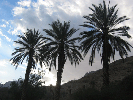
| On May
11th, Robinson and his party camped at the
En Gedi
oasis, opposite the shores of the Dead Sea.
Robinson writes that he arose at dawn. While
everyone else was loading the animals, Robinson
ascended the pass above the waterfall, hiking for 45
minutes to reach the top of the cliff. He
gazed over towards the east, to the Dead Sea and
reflected upon the destiny of the guilty inhabitants
of Sodom and Gomorrah, the ancient cities of evil.
(Genesis 19) |
| |
| |
|
 |
|
Photo:
Gila Yudkin |
|
Above the Dead Sea,
Robinson and his party camped by the En
Gedi waterfall |
| |
| Then
Robinson turned his attention southwards to
a ruin called Sebbeh by the Beduin and, with
the aid of a telescope, identified it as
Masada.
This was a bull’s-eye for Robinson. In his
words, |
| |
“The truncated summit of the lofty
isolated rock forms a small plain
apparently inaccessible; and this is
occupied by a ruin. We had been
greatly struck by its appearance; and on
examining it closely with a telescope, I
could perceive what appeared to be a
building on its northwest part, and also
traces of other buildings further east…
This spot was to us for the time a
complete puzzle. We thought at first
it might perhaps be the ruin of some early
convent. But subsequent research
leaves little room to doubt that this was
the site of the ancient and renowned
fortress of Masada, first built by
Jonathan Maccabeus, and afterwards
strengthened and rendered impregnable for
Herod the Great, as a place of refuge for
himself.
The description of Josephus corresponds
very exactly with the character of Sebbeh
as seen from a distance; and there is
little doubt that future travelers who may
visit its site will find other and more
definite traces of its ancient strength.
The building now visible on the northwest
and the columns described by the Arabs are
not improbably the remains of Herod’s
palace.”
(From Robinson’s Biblical Researches in
Palestine, Mount Sinai and Arabia,
published in Boston, 1841)
|
The reason
why no one before had identified Masada is
that first century AD historian Josephus
doesn’t say on which side of the Dead Sea
Masada was located. As a
matter of fact, one of Herod’s fortresses,
called Machaerus, is located on the eastern
side of the Dead Sea. Machaerus,
according to Josephus (Antiquities of the
Jews XVIII:5:1-2), is where John the
Baptist was beheaded. (Matthew 14)
Nearly 30 years after Robinson’s visit,
Captain Charles Warren
climbed Masada and affirmed Robinson’s
identification.
|
|
Bethsaida was a nameless tel,
known only as “Et-Tell,” i.e. “The Mound
of Ruins,” until Robinson passed through in
June 1838. Although it was located a
mile from the northern shores of the Sea of
Galilee, Robinson suggested this was
Bethsaida, a fishing village from the time
of Jesus and hometown of the disciples
Peter, Andrew and Philip.
Forty years later the German scholar
Gottlieb Schumacher explored the area,
looking for the best route to make railroad
tracks for a train from Haifa to Damascus.
Schumacher declared that Bethsaida was too
far from the Sea of Galilee. He
suggested a much more likely site called el-Araj,
for it was located on the northern shore of
the Sea of Galilee. For one hundred
years scholars argued whether Robinson or
Schumacher was correct.
In 1987, archeologist Rami Arav (today at
the University of Nebraska) carried out
probes at the two sites. The proof was
unequivocal: a settlement layer from the
Roman period existed only at Et-Tell.
Arav thus confirmed Robinson’s
identification of Bethsaida. Although
Bethsaida is today
far from the shores of the Sea of Galilee,
excavators have found many fishing
implements such as rods and lead weights for
nets, so that most scholars today agree with
Robinson’s conjecture. |
|
 |
|
Photo:
Gila Yudkin |
|
Tel Bethsaida may have
looked something like this
when Robinson dropped some coins as he was
traveling through |
| |
| In late 1999
I participated in a full-day seminar for
guides on site at Bethsaida. Rami Arav
told us that during the dig they had found
two American coins. Presumably they
had fallen out of the pocket of Edward
Robinson. If I remember correctly,
(unfortunately I wasn’t as prodigious a
note-taker as Robinson!) the archeologist
told us that they were from the period of
Andrew Jackson! |
| |
Robinson
also identified my favorite biblical site,
Tel Dan.
Tel is a Hebrew word meaning “a mound
of ruins.” Tel is found in the
Hebrew Bible five times altogether; twice in
Joshua, in connection with the conquest of
Ai and the conquest of Hatzor. This is how I
imagine Robinson “discovered” Dan:
Robinson would deliberately not strike up
conversation with the locals, fearing that
they would make up stories about what they
thought he wanted to hear. He would
simply point to topographical features on
the landscape, and then Eli Smith would ask
the local farmers in Arabic, “what’s this
called; what’s that called?” When
Robinson pointed to the high mound above the
headwaters of the River Jordan, a local
riding by on a donkey told Smith it was
called “Tel el Kadi.” Smith translated
this as the “mound of the judge.”
Robinson thought for a moment and opened his
Bible. Then he snapped his fingers and
said, “Hey this must be the
ancient city of Dan."
And so it was! Robinson had simply opened
his Kings James Version of the Bible to
Genesis 49:16, “Dan shall judge his people
as one of the tribes of Israel.”
Natives of the upper Galilee had preserved
the original biblical name of the city by
translating it into Arabic. |
| |
|
 |
|
Photo:
Gila Yudkin |
|
Limestone synagogue at
Capernaum, located by Robinson |
| |
Robinson
also identified not only
Capernaum, the
headquarters of Jesus public ministry in the
Galilee, but also suggested the remarkable
white limestone columns and Corinthian
capitals lying around on the site had once
graced the synagogue at Capernaum.
Like Bethsaida, Capernaum’s location was
vigorously debated by scholars for the next
hundred years. I see it as a
fulfillment of Jesus’ prophecy when he
cursed both cities,
|
“Then he proceeded to denounce the
towns where most of his miracles were
done, because they did not repent:
Woe to you Chorazin! Woe to you Bethsaida!
For if the miracles that were done in you
had been done in Tyre and Sidon they would
have repented in sackcloth and ashes long
ago! But I tell you, it will be more
tolerable for Tyre and Sidon on the day of
judgment than for you. And you,
Capernaum, will you be exalted to heaven?
You will go down to Hades.” (Matthew
11)
|
If the Bible
has an important place in your life, then
why don’t you make a pilgrimage to the Holy
Land? It’s a lot easier than it was in
Robinson’s day (and
air-conditioned). You can visit the synagogue at
Capernaum, the mound of the ancient city of
Dan, Peter’s hometown of Bethsaida and
Herod’s fortress at Masada, all identified
by Robinson. You can walk on the
2,000-year-old sidewalk right under
Robinson’s Arch. And, this Connecticut
Yankee who has been living in King David’s
Court for over 30 years will be happy to be
your guide!
|
|
Copyright 2007,
2009
Gila Yudkin. Permission needed for any reuse. |
| |
Coming to Jerusalem
this year?
Would you like to find the venues
where you can
quietly be transported back in your imagination to
the time of Jesus? David? Abraham?
Make every minute matter while you "Explore
Jerusalem's Soul" with
Gila's Unorthodox Guide.
This up-to-date PDF (Adobe Acrobat) 46-page guide
gives you the Top Ten places to meditate on the
Bible, the Top Ten lesser-known churches worth
visiting, the Top Ten most rewarding roof-top
views and the top Ten places for sampling Middle Eastern
soul food. More on
Gila's Guide....
|
| Read
what Edward Robinson missed discovering
when he located
Hezekiah's Tunnel
in 1838. |
| |
| Are you
going to be leading a tour to the Holy
Land? Read
Gila's Tips for Holy Land
Tour Leaders, from A to Z. |
| |
| Read
about
Gila Yudkin, a
Connecticut Yankee
relocated to King David's Court. |
| |
| More Holy Land
headliners and celebrities
|
|
|
|
|
|
GILA
YUDKIN
•
TCHERNIKOVSKI
64A
•
JERUSALEM
•
ISRAEL
gila@itsgila.com
HOME
•
BOOK
GILA •
TIPS
FOR TOURS •
ABOUT GILA
|
|
